
 |
| Teddy Roosevelt National Park |

Our first stop was the South Unit of Theodore Roosevelt National Park and its stunning badlands. We wondered what the cattleguard was for as we drove across it, no cattle in sight. Then we ran into this fellow and a bunch of his cousins crossing the road. Later on, we drove right past a prairie dog town and Ruthie caught
 |
| Prairie Dog |
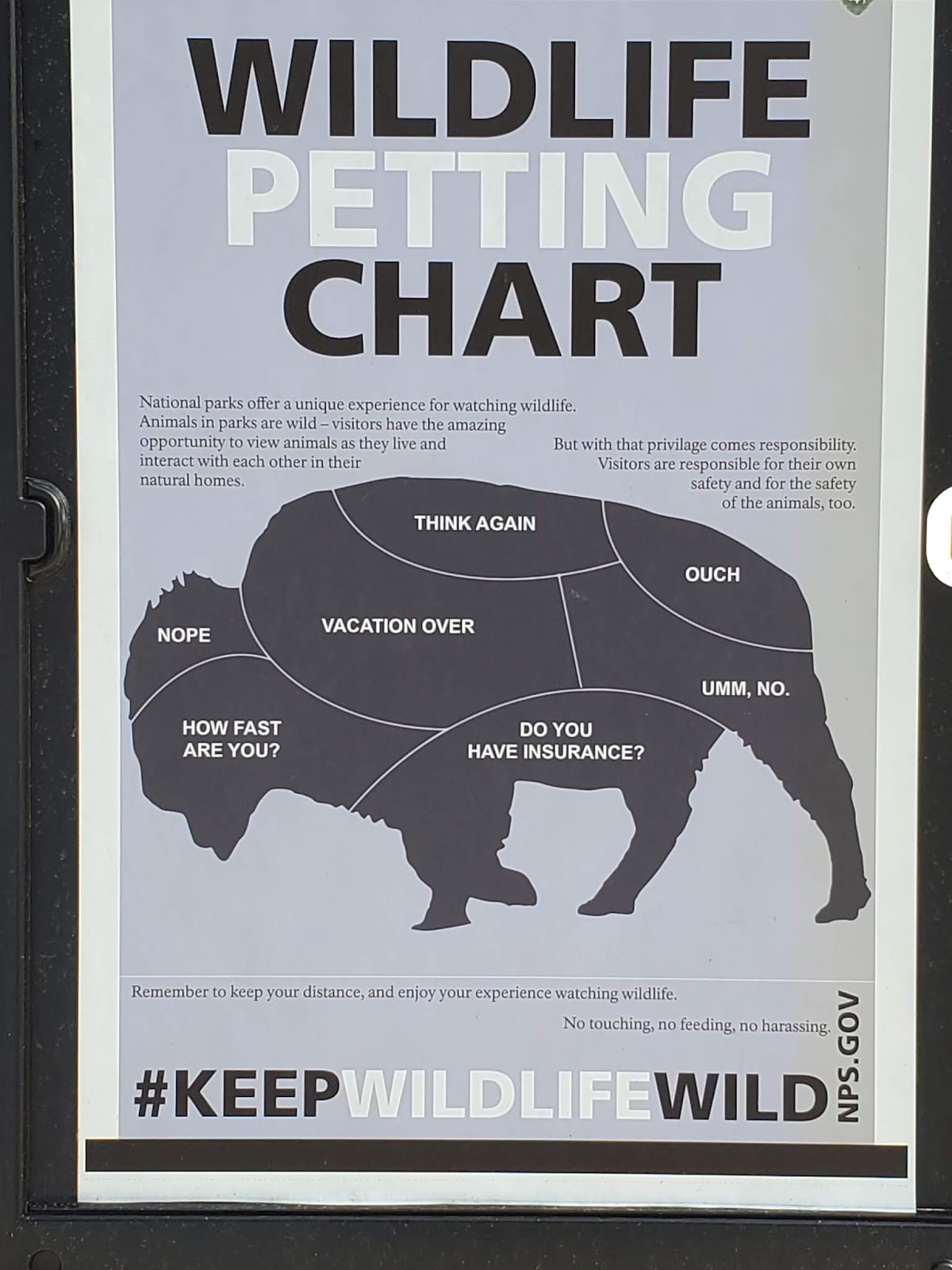
Leaving the park, we stopped by the gift shop and snapped this poster. Ruthie says they should put these labels on a person and send it to Joe Biden. I
It is impossible to convey in pictures or in words, at least those available to me, the vastness of what we are passing through. I attempted a panorama shot, but we really need

Our next stop was Fort Union and the Confluence Interpretive Center. We were skirting the edges of the Central and Mountain time zones and our watches kept doing flips, which added to our disorientation--as if the incredibly vast and changing landscape weren't
 |
| Entrance to Ft Union. |
 |
| The most elegant post on the Missouri |
 |
| Trading Room Ft Union |
wall.
We also visited a state site, the Confluence Interpretive Center. It is the place where the Missouri and the Yellowstone Rivers come together. L&C had to make some important decisions
 |
| Missouri meets Yellowstone |
So we asked the young attendant at the desk which of the Google Map alternatives was the best way to get to our last stop, Fort Peck. He said the main road, Route 2, was full of road construction and suggested the gray line, Route 201. Then he laughed and said, "There's NOTHIN' out there, you'll love it!" He was not kidding. There truly was nothin' out there, including pavement for 26 miles. No homes, no businesses, just pasture, hay and wheat fields. We passed occasional clumps of trees

We did see many other things on our travels yesterday, always beneath a vast, ever-changing sky. Take your time and enjoy them as we did.


 |
| Blessing at day's end |
Iconic...
ReplyDelete